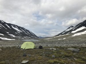
08:00 Camp in center of Kaskasavagge
 The night here in Kaskasavagge was cold and comfortable, what a difference when not having to make an effort to just keep the equipment dry.
Frankly I can’t remember when I woke up with a dry tent last time, I’d have to go back and look through my journals.
Today is overcast yet it looks like it will stay dry for now at least, the clouds give this valley a more sinister atmosphere and a feeling of ancient times. It would not be surprising to see a woolly mammoth turn up behind a huge rock.
 I’m setting out to start the day going over the pass to Goubirvaggi, then follow that valley westwards back to Tjäktjavaggi and enter Sinnivagge. A few km up that valley I know a really good camp site that I intend to use the coming night.
Then the weather will determine how I continue towards Kebnekaise.
As the afternoon snack yesterday really bumped both my Ketonix readings and my energy levels I chose to complement my fat coffees this morning with some nuts, jerky and ghee. We’ll see how that turns out during the day!
17:05 Camp in Sinnivagge
First let me break the news that I hiked in my normal hiking pants all day, can’t even remember the last day I had no need to change into rain pants!
I’m so incredibly grateful for this beautiful weather, it’s been a little on and off all day yet dry all day through and now I have the sunshine hitting the tent from the east and a beautiful view over the Ruskkas mountains I past on their eastern side just days ago.
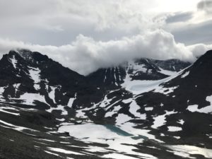
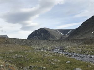
The hike today was marvelous, first the ascent to the summit – beautiful views and quite a lot of snow to walk on. I prefer the snow though it’s more physically demanding than rock as one has to kick hole into the snow for each step. It’s just so much easier on joints and ligaments!
It took me about an hour to climb the pass and I made a little video at the summit.
The way down was a lot of fun yet very demanding – I could utilize a few huge snow fields to avoid descending on rocks and it takes an enormous amount of concentration to stay in control on the snow.
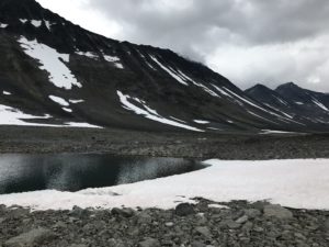
Once down at the bottom I hiked a few more km before my eyes and brain needed a little rest and refueling so I took a snack break right down at the lake.
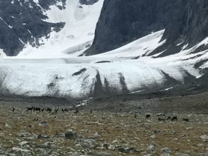
Continuing 45 min later I was perfectly ok with having to go all the way down to Kungsleden and use the bridge to cross Guobirjohka. Fortunately that wasn’t necessary, I kept pretty much south and soon after clearing ‘Drakryggen’ (the mountain is called ‘dragons back’ due to its shape) I saw not only Rabots glacier and a grassing herd of reindeers, but also a wide area of the river where it looked passable. It was indeed and I didn’t even have to get my feet wet!
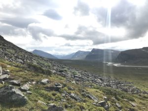
After the crossing I went down quite some in elevation to round Guobircohkka and turn back east into Sinnivaggi. Nice soft grass to walk on and very easy to find reindeer tracks to follow.
 The actual trail along Sinnjijohka is on the south side of the stream, yet that’s a well worn out trail and I prefer to hike on the north side instead. The first ascent into the valley is physically much more demanding as one needs to climb up to avoid a steep field of rocks. After that it levels out and follows the stream up to the grass field in Sinnivagge.
Once arrived here I just set up camp and got myself some hot tea so now it’s time for an early dinner and probably an early night as well. I’m a little weary after the last two days, more mentally than physically.
Most guide books recommend doing one of these passes per day only and there’s been quite some additional hiking these days.
I guess I just need some rest and recovery and we’re all good again!
Time to relax and enjoy the beautiful spot here in Sinnivagge!
The journey continues, please leave a comment to tell me what You think and share this with friends and loved ones who might benefit or be interested!
By leaving Your name and email in the box below You get notification of futures posts and news!
Peace // Claes
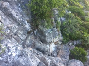
 ad of the hike my choice to follow the “Rim trail” up to the Newlands Gorge turned out to be an interesting one. The trail started out as a beautiful small path that soon got fainter and then even fainter, at times it was almost invisible and it became clear that it was used mainly by game, not hikers. Lots of fun, though, to climb over and crawl under obstacles and I did not at all mind the hour it took me to reach the contour path.


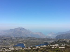
 Traverse path following this around the northern edge of the mountain aiming to get down to Kings Blockhouse.
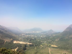
 Heading for the Café at the upper station for a nice double Cortado I made a new friend from Perth, Australia and got company for the rest of the hike. We took the trail leading south to the Woodhead reservoir, crossed the dam and turned east heading for Kirstenbosch Garden through Skeleton gorge.
 The decent through Skeleton Gorge soon follows a creek carrying no water this time of the year yet should be impossible to pass during rain fall. Leading through beautiful shady forrest and offering fun climbing parts and even a few ladders it´s a treat after the scourging sun on the top af the mountain. A short walk after reaching the bottom of the gorge lies the botanical garden of Kirstenbosch, unfortunately I didn´t have time to explore the garden itself, got that saved for another day!
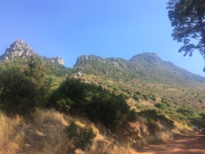
 the hike became more of a climb in some sections!
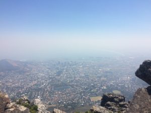
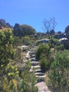 de, aiming to follow Smuts Track up to the peak of Table Mountain.