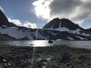
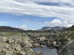
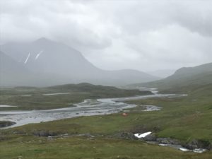
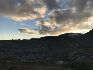
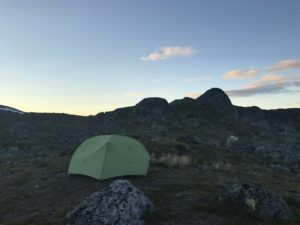
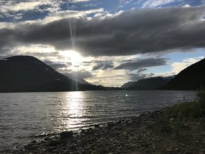
07:00 Camp in Sinnivagge
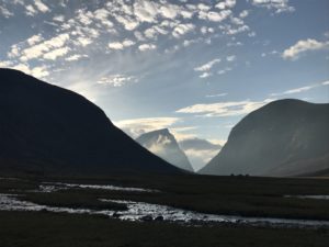
It’s a beautiful morning, I got out of the sleeping bag about half an hour ago and have just finished my first coffee with coconut oil. The sky was already mostly blue and clear yet the sun still hidden behind Sinnibakti. Soon after the earth had rotated enough for the mountain to have moved and the rays of the morning sun now hit my tent and warms the air inside.
 Temperatures outside still clearly indicate that summer is at its end and we’re in the season of fall here in the mountains.
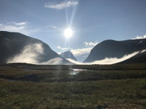
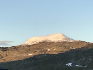
Anyway, being greeted by the sun like this in the morning is not only a great gift from God, it also determines the tour for today. With this weather it would not just be unappreciative but almost heresy to not go for the summit of Kebnekaise. They say that in clear weather one can see 11% of Sweden from up there and this alone is worth some soreness in feet and joints from climbing on rocks and stones. Today they should also be wonderful nice and dry!
I still need to rearrange my equipment and get the last food rations up from the bottom before I leave here. Such a blessing to be able to get that done out here without having to hurry the reorganization process due to bad weather!
Time for another cup of coffee and getting started with this beautiful day!
22:00 Camp near Keb station
What a fantastic hiking day, definitely the physically toughest so far and maybe the toughest of the entire trip. That’s still to be determined!
I got started shortly before 09:00 and followed the stream first northward on the western shore, then, after it started turning eastward I crossed over on the south side. Mostly I stayed on the trail yet some snow fields next to the stream were impossible to resist.
Generally the whole valley was pretty moderate hiking, just constantly uphill which always takes its toll on the hiker.
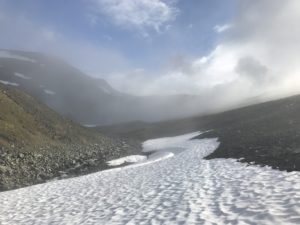
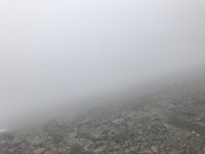
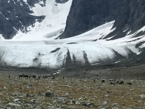
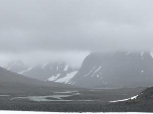
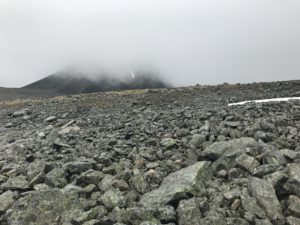
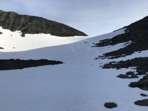
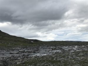
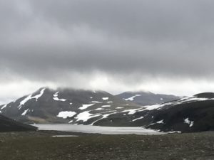
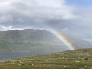
 After reaching the end of Sinnivaggi and starting the climb up the whole action got considerably rougher and the clouds started closing up. Still I decided to go for the summit as I saw a chance of the weather lightening up. Turning sharply uphill to converge with the western trail towards the summit of Kebnekaise carrying me whole backpack admittedly turned out to be brutally challenging. The tour is partly very steep and rather slippery as the stones have been ground into gravel by many feet passing. I motored on slowly and, at times, felt like I’d never reach the end – a feeling greatly enhanced by the clouds closing in even more, lowering the visibility to just 10-15m. It’s just inherently frustrating to not being able to see where one is heading – until making a mental decision not to care any more and just go on. And that’s exactly what I had to do… I knew that sooner or later I’d reach the summit and until I did, I’d just keep putting one foot in front of the other.
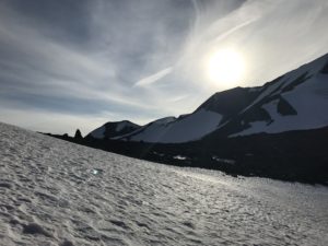
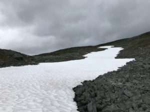
The last climb was on packed snow and ice, I was so grateful for my practice sessions, kicking my boots into the snow, I got during the last days pass crossings.
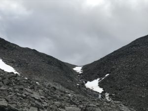
Finally reaching the highest point in Sweden offered a view resembling the inside of a milk carton – the clouds did not lift or dissolve, yet I had climbed the highest mountain in Sweden carrying all my gear, still weighing 22-23kg (somewhere in the realm of 45-50lbs). And I’d done it on two coffees with coconut oil and some PF dissolved in water, without any real breaks in the way up and still feeling energized and strong!
Down at the safety cabin to get some rest and have a snack I got enough water for a coffee, mixed in some PF and downed a bag of nuts. Shortly after the door opens and a man asked if anyone was hungry.
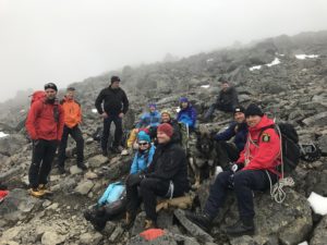
Turns out the search and rescue people, who came to help the crashed plane in 2012, had returned for a reunion – and they had left over hamburgers. I was easily persuaded to dig in on a few hamburger patties and a bunch of cheese.
Soon thereafter I left the shelter and started the descent, getting the first part done in under an hour, finding some running water and drank a few cups. The rest of the way down was tedious and hard on joints and ligaments, many meters of elevation downhill still to be covered and still no real physical or mental fatigue.
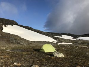
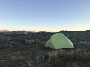
Reaching the area around Keb station just 3:40 after leaving the summit I spent some time finding an acceptable camp site. Late in the day that wasn’t easy, yet my tent fits smaller spots than most and finally I had my place and could go for a coffee.
The hamburgers still had me feeling sustained and my ketone readings were excellent and so I decided to leave dinner for tomorrow and just have a light snack in anticipation of the breakfast tomorrow morning.
The journey continues, please leave a comment to tell me what You think and share this with friends and loved ones who might benefit or be interested!
By leaving Your name and email in the box below You get notification of futures posts and news!
Peace // Claes
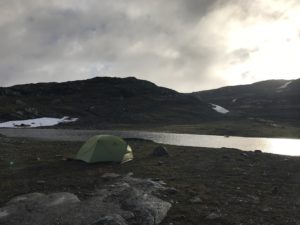
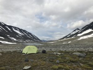 The night here in Kaskasavagge was cold and comfortable, what a difference when not having to make an effort to just keep the equipment dry.
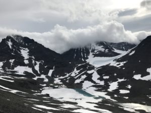 I’m setting out to start the day going over the pass to Goubirvaggi, then follow that valley westwards back to Tjäktjavaggi and enter Sinnivagge. A few km up that valley I know a really good camp site that I intend to use the coming night.
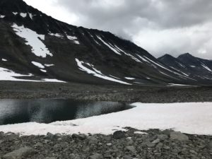
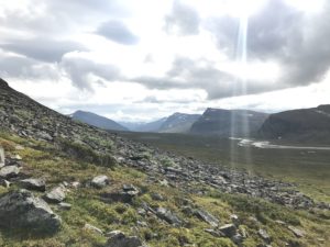
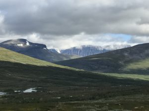
 The actual trail along Sinnjijohka is on the south side of the stream, yet that’s a well worn out trail and I prefer to hike on the north side instead. The first ascent into the valley is physically much more demanding as one needs to climb up to avoid a steep field of rocks. After that it levels out and follows the stream up to the grass field in Sinnivagge.
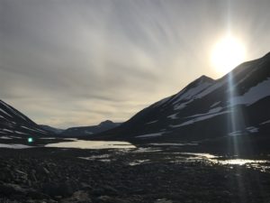
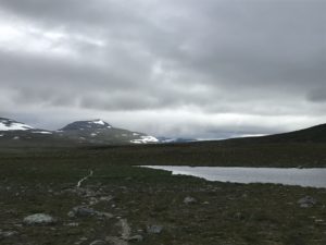
 Using the trail kept me roughly away from the wet bushes and scrubs, thereby helping to avoid soaking the boots within the first few km.After about 7km I left the trail and started working my way up the mountain side and turn into the western part of Unna Reiddasvagge. The ground was almost inconceivably drenched were there were no rocks and the rocks themselves were wet and slippery. Approaching the opening of the valley I suddenly found myself at about the same elevation as the clouds and really thought it’s have to hike in fog for the rest of that part.
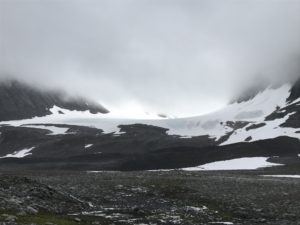
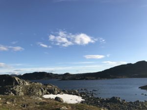
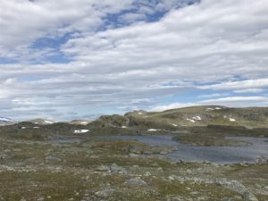
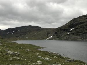
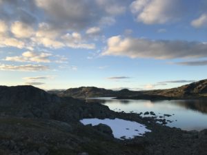
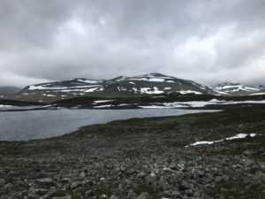
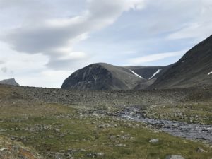
 As I wanted to check out Battajavri and look for camp sites around that lake for future purposes, I kept my elevation after reaching about 950m and went around the mountain. Soon I had to go down some again to get off the super slippery wet rocks higher up on the mountain side. There were a few snow fields I could utilize to make the hike softer on joints and ligaments.
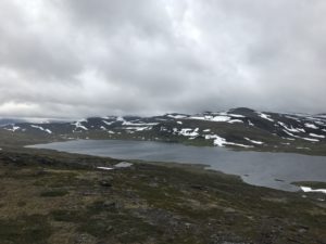 Originally I planned to stay east of Rusjka and merge with Neasketvaggi at its northern end, yet the wind was to strong to safely hike a steep mountain side I didn’t know from earlier experience. So I turned west to go pass Ruskajavri on its eastern side.
 I got going just about 10am and the first 8km to Kaitumjaure cabin were done with in little over two hours. Kungsleden is not that inspiring to hike as it is very eroded, yet it is fast and the surroundings are really beautiful!
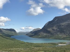 At the cabin I didn’t get much information about the area I was looking to hike, I did get another interview for ‘
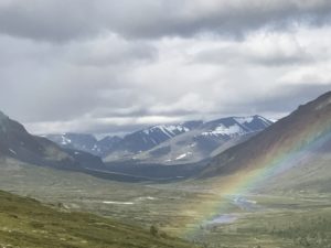 Turns out that just about a km from the cabin I find a trail leading west up to the summit of Sanarcohkka. So I followed that trail until I was well clear of the tree line before turning northward and returning to follow reindeer tracks.
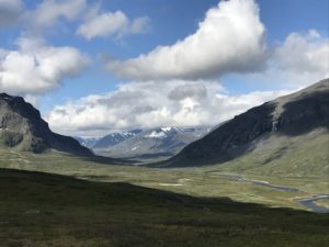 The wind that kept my camp free from mosquitoes last night and this morning increased steadily throughout the day. Coming from northwest and being rather chilly it made this day feel a lot more like early fall than late summer. Also I saw some yellow leaves on the birches already so it seems Lappland got a quite short summer this year.
 Leaving the cabin at ten to 3 in
 What a beautiful morning! I’m sitting in my tent with the abside open on the leeward side, facing the sun. The rather chilly wind from behind drives away most mosquitoes except for the very bravest, and the sun gives a nice warmth to the morning hours!
 Plan for today is to go all the way to Saltoluokta as the weather could hardly be better and I’ll get an early start.
 I have to admit that the first hour or so was a struggle… Lots of vegetation, wetlands and pools of standing water to be avoided and really no straight line to follow despite my efforts of aiming at the high point. In these situations it always feels like the forward progress is frustratingly slow and it becomes a mental game besides the physical struggle with the uneven ground and getting hooked up in the vegetation all the time.
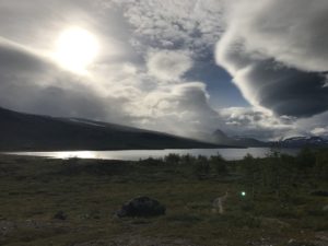 The rest of the hike to the eastern end of Bietsavvre was pure joy, mixing grassland with rocks and some occasional bushes that I’ve got increasingly better at avoiding!
 Unfortunately the cafe in the Sami village was closed and so I continued almost immediately along the trail down to Saltoluokta. The six km trail was super easy to follow and after a slight uphill slope merely downhill, after just under an hour I reached the fjällstation and checked in for a camp site. Sara at the reception was kind enough to help with recharging my Ketonix battery and the power bank over night, turns out she’s been following LCHF earlier and got of it during guide training.